Phoenix sits at 1,086 feet above sea level, sprawled across the Salt River Valley floor. The basin fill here is complex—interbedded sands, gravels, and cemented caliche layers that defy uniform assumptions. A 2023 USGS report mapped over 200 feet of alluvial deposits beneath downtown. That heterogeneity makes desk-study permeability guesses unreliable for any project involving water. A test pit can expose shallow stratigraphy, but only an in-situ Lefranc or Lugeon test quantifies hydraulic conductivity at depth. The team runs these tests following ASTM D4630 and USBR procedures, using inflatable packers and constant-head step methods. Data feeds directly into dewatering plans, infiltration basin sizing, and curtain grouting designs across Maricopa County.
Lugeon testing in cemented caliche often shows a 10x permeability jump between the second and fourth pressure stage—something a lab test alone will never reveal.
Methodology and scope
Local ground factors
The Salt River Valley subsurface is not hydraulically simple. Pre-consolidated Pleistocene alluvium can have vertical permeabilities two orders of magnitude lower than horizontal values due to clay seams and caliche stringers. In the West Valley, groundwater perched on cemented horizons creates unexpected artesian conditions during excavation. The IBC requires in-situ permeability data for any dewatering system serving a structure deeper than 10 feet below groundwater. Skipping field tests and relying on grain-size correlations produces errors of 50x or more in stratified desert soils—a mistake that surfaces as flooded excavations, failed infiltration basins, or grout takes 300% over budget. For projects near the Salt River channel, where gravel lenses transmit water rapidly, a CPT sounding provides continuous stratigraphic context that helps target Lugeon test depths precisely to the most permeable horizons.
Applicable standards
ASTM D4630 – Standard Test Method for Determining Transmissivity and Storage Coefficient of Low-Permeability Rocks by In Situ Measurements Using the Constant Head Injection Test, USBR 6510 – Lugeon Testing for Rock Mass Permeability (United States Bureau of Reclamation Earth Manual), IBC Section 1803.5.5 – Foundation and Soils Investigations: Groundwater Table and Permeability Requirements, ASTM D6391 – Standard Test Method for Field Measurement of Hydraulic Conductivity of Porous Materials Using Borehole Infiltration Method (Lefranc-type)
Related services
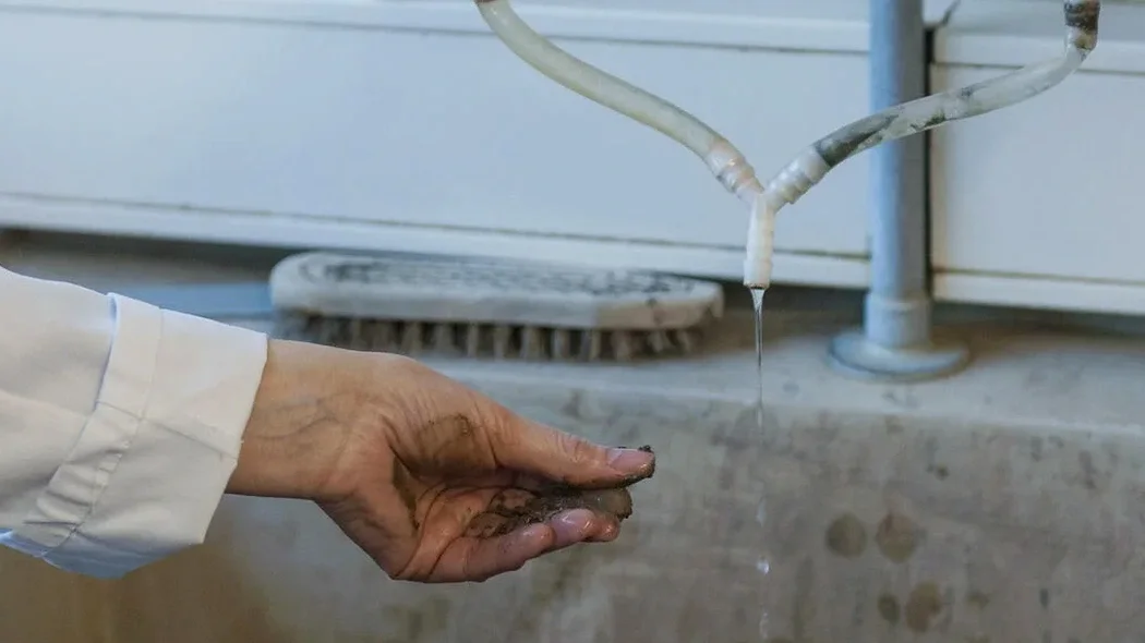
Lugeon packer testing
Injection testing in rock and cemented caliche using single or double packer setups. Five pressure stages reveal hydraulic fracture potential and true rock mass permeability.
Lefranc falling-head tests
Point measurements in granular alluvium above groundwater. Fast execution in 4-inch auger holes. Ideal for infiltration basin design per ADWR requirements.
Multi-level permeability profiling
Sequential Lefranc or Lugeon tests at 2–3 meter depth increments within a single boring. Builds a vertical conductivity profile for layered basin fill.
Dewatering permeability assessment
Focused testing campaign delivering the k-value input for MODFLOW or SEEP/W models. Includes transmissivity estimates for wellpoint and deep-well system design.
Typical parameters
Questions and answers
What does a field permeability test cost in Phoenix?
A single Lefranc test interval typically runs between US$650 and US$970, including mobilization within Maricopa County, the test execution, and a signed report. Lugeon testing in rock adds about 20 percent due to packer equipment and longer stage durations. Projects needing multiple intervals or combined CPT profiling receive bundled pricing.
How many test intervals do I need for a dewatering design?
Minimum one interval per distinct soil layer within the anticipated drawdown zone. For a 30-foot excavation in Phoenix basin fill, that usually means 3 to 4 Lefranc tests targeting sand lenses, gravel seams, and the saturated caliche horizon. IBC guidance ties the number of tests to site variability, not just project size.
Can you test in caliche without it washing out?
Yes. Caliche requires a conservative pressure ramp. We start at 50 percent of the estimated overburden pressure and monitor flow stability for three minutes before advancing. If the caliche shows fissure erosion—a sudden flow increase—the test is halted and re-run at a lower maximum pressure. The Lugeon pattern itself diagnoses the washout threshold.
How long until I get the test data?
Preliminary k-values are available same-day via email. The final signed report with pressure-versus-flow plots, Lugeon unit calculations, and stratigraphic correlation arrives within 48 hours. Rush processing for next-day delivery is available when excavation permits are pending.