Phoenix construction faces a unique challenge: deep excavations in cemented alluvium and caliche layers that behave like rock until they don't. The International Building Code (IBC) and OSHA Subpart P require continuous geotechnical monitoring when a trench exceeds 5 feet or when adjacent structures sit within the zone of influence. We supply and read the instruments—inclinometer casings behind soldier pile walls, optical survey prisms on neighboring foundations, and vibration monitors that log every truck pass. For projects near the light rail corridor along Central Avenue or older masonry buildings in the Roosevelt Historic District, a CPT test ahead of shoring design gives us the soil stiffness profile we need to set threshold alarms correctly, and we often tie that data into a broader liquefaction screening when the water table is shallow near the Salt River channel.
In cemented desert soils, the failure mode is brittle and sudden—monitoring buys the minutes you need to react.
Methodology and scope
Local ground factors
Phoenix sits at 1,086 feet above sea level, and its surface geology is dominated by coarse-grained alluvial fans that drain fast—until you hit a buried paleochannel full of silty clay. We've seen a trench in the Arcadia area lose 3 inches of ground behind a shored face within 48 hours because a pocket of uncompacted canal fill went undetected during the geotech investigation. The risk isn't just the excavation collapse; it's the settlement that propagates 40 feet outward and cracks a slab-on-grade house built in 1952. Our team tracks total station coordinates every morning before the desert sun distorts readings, and we compare movement vectors against the project's allowable deformation criteria. If the trend line curves upward, we halt work, notify the engineer of record, and don't resume until the shoring design is rechecked.
Watch the video
Applicable standards
IBC 2021 Section 3304 – Excavation, Grading, and Fill, OSHA 29 CFR Part 1926 Subpart P – Excavations, ASTM D6230 – Standard Guide for Monitoring Well Installation, USBM RI 8507 – Blasting Vibration Standards
Related services
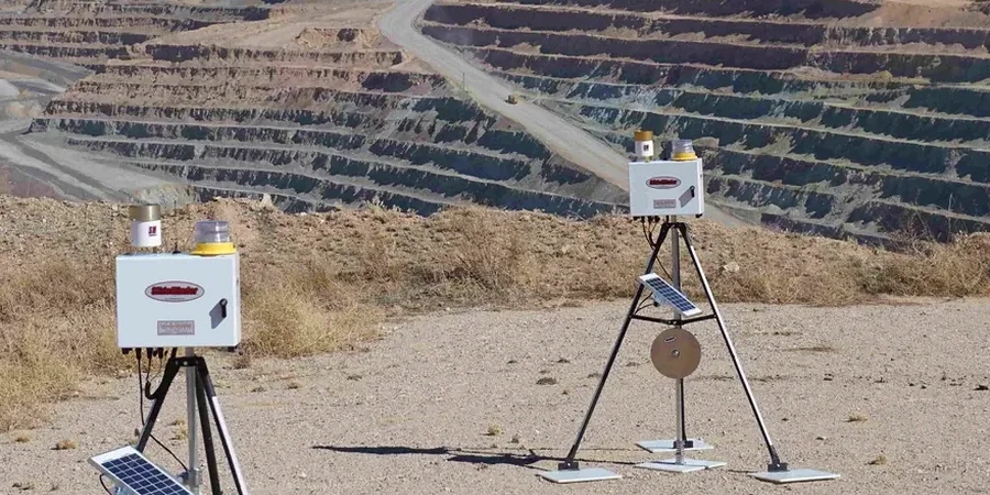
Inclinometer & Tiltmeter Arrays
Vertical inclinometer casings installed behind shoring walls to track lateral deflection with depth. Data processed weekly against design envelopes.
Optical Survey Monitoring
Total station networks with fixed prisms on adjacent buildings, pavements, and utilities. Baseline readings taken before any earthwork begins.
Vibration & Noise Monitoring
Triaxial geophones set at the nearest occupied structure, logging peak particle velocity in real time with email alerts for threshold exceedance.
Crack & Settlement Documentation
Avongard-style crack gauges and settlement plates installed at the excavation perimeter. Photographic logs accompany every reading cycle.
Typical parameters
Questions and answers
What triggers a stop-work order during excavation monitoring?
We stop work when lateral movement exceeds 75% of the design allowable, when settlement reaches 0.5 inches on an adjacent footing, or when vibration exceeds 0.5 in/s PPV at a residential structure. The field technician calls the superintendent immediately, then emails the reading log to the geotechnical engineer of record within the hour.
How much does excavation monitoring cost in Phoenix?
A typical 4-week monitoring program with two inclinometer stations, ten survey prisms, and one vibration station ranges from US$830 to US$2,360 depending on site access, instrument count, and reporting frequency. Projects requiring automated total stations with 24/7 uplink sit at the higher end of that range.
Do you handle the instrumentation installation or just the readings?
We do both. Our crew drills and installs inclinometer casing, sets survey benchmarks, and mounts crack gauges. We also take the initial baseline readings and handle all subsequent monitoring visits. The data package includes signed field logs and a summary chart for the building department.
How often are readings taken during the excavation phase?
During active digging near the shoring face, we take readings daily. Once the excavation reaches final grade and the permanent structure begins going up, the frequency drops to twice weekly, then weekly after backfill. We adjust the schedule if the data shows a trend that needs tighter observation.